

Overview: The Shipwreck & Sea Turtle Capital of the Lesser Antilles
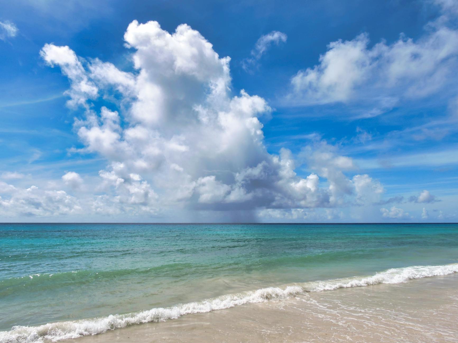
Curving along the southwestern edge of Barbados adjacent to the historic capital of Bridgetown, Carlisle Bay Marine Park (13.0854° N, -59.6133° W) is universally celebrated as the most reliable, atmospheric, and accessible sea turtle encounter in the Eastern Caribbean.
Historically serving as a sheltered natural anchorage for British merchant armadas and naval frigates during the 17th to 19th centuries, this sweeping crescent bay now harbors a world-class underwater marine park. The sandy bottom of Carlisle Bay is famously punctuated by six sunken shipwrecks—including the Berwyn (a French tug scuttled in 1919), the Bajan Queen (Barbados’s first tugboat), the Eilon, and the C-Trek—resting at depths ranging from just 2.0 to 12.0 meters (7 to 40 feet).
These historic wrecks serve as thriving artificial coral reefs, drawing clouds of tropical fish and creating an idyllic habitat for wild Green Sea Turtles (Chelonia mydas) and critically endangered Hawksbill Turtles (Eretmochelys imbricata) . With an independently verified 97% sighting probability year-round, travelers can either wade directly into the calm, glassy turquoise waters from the powdery sands of Pebbles Beach and Brownes Beach, or join luxury sailing catamarans that anchor over the wrecks for guided morning snorkeling.

Barbados: Carlisle Bay Shipwrecks & Turtle Snorkel Cruise
Top-rated 3-hour catamaran cruise across Carlisle Bay to swim with wild sea turtles and explore historic coral shipwrecks with open bar.
Marine Ecology: Shipwrecks & Seagrass Beds
Carlisle Bay’s exceptional marine life concentration is driven by the harmonious juxtaposition of two contrasting benthic environments: expansive natural seagrass meadows and towering iron shipwrecks.
   [ Surface Water (Carlisle Bay Lagoon) ] ~~~~~~~~~~~~~~~~~~~~~~~~~~~~~~~~~~~~~~~~~~~
                                           │ (3-Meter Mandatory Standoff Buffer)
                                           ▼
   [ Shipwreck Artificial Reefs ]         🐢 [Green & Hawksbill Sea Turtles]
   (Depth: 2.0m - 10.0m)                   │ Feeding on Sponges & Thalassia
                                           ▼
   [ Sandy Seagrass Meadows ]             vvvvvvvvvvvvvvvvvvvvvvvvvvvvvvvvvvvvvvvvvvv
                                          Thalassia testudinum & Encrusting Corals
Turtle Foraging Dynamics in Carlisle Bay
- Green Sea Turtles (Chelonia mydas): The shallow sandy basin (1.5 to 4 meters depth) between Brownes Beach and the wreck buoy line is carpeted with lush Turtle Grass (Thalassia testudinum) and Halodule wrightii. Green turtles graze peacefully on the tender grass shoots, completely unfazed by quiet snorkelers floating above.
- Hawksbill Turtles (Eretmochelys imbricata): Hawksbills inhabit the rusted steel hulls and wooden decking of the sunken wrecks. The ships’ iron superstructures are heavily encrusted with sponges, bryozoans, and colonial tunicates, offering an inexhaustible banquet for foraging Hawksbills.
- Reef Fish Ecology: The shipwrecks support colossal schools of French Grunts (Haemulon flavolineatum), Sergeant Majors (Abudefduf saxatilis), Horse-eye Jacks, Southern Stingrays, and camouflaged Seahorses (Hippocampus reidi).
Bathymetric Depth Profile & Shipwreck Topography
The seabed of Carlisle Bay slopes gently from the white sandy beach out toward the outer mooring line:
PEBBLES BEACH SAND ENTRY   SHALLOW SEAGRASS BEDS    BERWYN SHIPWRECK         BAJAN QUEEN WRECK
[0.0m - 1.5m]              [1.5m - 3.5m]            [2.0m - 4.5m]            [5.5m - 10.5m]
      │                          │                        │                        │
  🏖️ Soft Powder Sand       🌱 Thalassia Meadows     🚢 Historic French Tug   🚢 120ft Sunken Tugboat
    Calm Wading Entry          Green Turtles Grazing    Hawksbills Feeding       Schooling Jacks
    Family Friendly            Stingrays                Depth to Top: 2.0m       Deep Free-Dive
Depth & Wreck Breakdown:
| Site Name | Depth to Top / Floor | Historical Background | Dominant Marine Life | Snorkel Experience |
|---|---|---|---|---|
| Shoreline Grass Flats | 1.0 m – 3.0 m (3 – 10 ft) | Natural soft sand and Thalassia seagrass beds | Foraging Green Sea Turtles, Southern Stingrays, Flying Gurnards | Prime Shore Snorkel Zone. Safe, shallow, and directly accessible from Pebbles Beach. |
| The Berwyn Wreck | 2.0 m – 4.5 m (7 – 15 ft) | 70-foot French naval tugboat sunk in 1919; covered in hard brain corals | Hawksbill turtles, Sergeant Majors, French Grunts | Best Snorkel Wreck. Mast and bow sit just 6 feet below the surface; ideal for beginners. |
| The Bajan Queen | 5.5 m – 10.5 m (18 – 35 ft) | 120-foot historic tugboat sunk in 2002 as an artificial reef | Great Barracudas, Horse-eye Jacks, resting Green turtles | Spectacular full ship outline visible in 20m clarity; popular for free-diving swim-throughs. |
| The Eilon & C-Trek | 6.0 m – 12.0 m (20 – 40 ft) | Combined cargo vessels scuttled in the 1990s | Spotted Eagle Rays, Moray Eels, juvenile reef fish | Deeper wrecks situated 200 meters offshore; viewed effortlessly from the surface. |
ASCII Shore-Entry & Swim Route Map: Carlisle Bay
+=============================================================================================+
|                      CARLISLE BAY MARINE PARK (BARBADOS) - SNORKEL MAP                      |
+=============================================================================================+
|                                                                                             |
|                           CARIBBEAN SEA (DEEP WATER ANCHORAGE)                              |
|                                                                                             |
|   ~ ~ ~ ~ ~ ~ ~ ~ ~ ~ ~ ~ ~ ~ ~ ~ ~ ~ ~ ~ ~ ~ ~ ~ ~ ~ ~ ~ ~ ~ ~ ~ ~ ~ ~ ~ ~ ~ ~ ~ ~ ~ ~ ~   |
|   =======================================================================================   |
|   [ OUTER SHIPWRECK CHAIN: BAJAN QUEEN (10m) | EILON (12m) | C-TREK (11m) ]                 |
|   =======================================================================================   |
|                                             │                                               |
|                                             ▼                                               |
|   .......................................................................................   |
|   :  [NORTH SHIPWRECK ZONE]       |   [CENTRAL TURTLE FEEDING ZONE] |  [SOUTH BUOY LINE]    :   |
|   :  🚢 [The Berwyn Wreck (3m)]   |   🐢 [Green Turtles Grazing]    |  🪸 [Coral Nursery]   :   |
|   :  (Depth to top: 2.0m)         |   🌱 [Thalassia Grass Pasture]  |  (Depth: 3.5m)        :   |
|   :...............................|.................................|.......................:   |
|                                   |                                 |                       |
|   --------------------------------+                                 +--------------------   |
|   |         [SAFE BUOYED SWIMMING CORRIDOR (Depth: 1.5m to 4.0m)]                       |   |
|   |         * Boat exclusion zone marked with high-visibility white buoys               |   |
|   |         * Direct 100m - 150m swim from shoreline out to the Berwyn wreck            |   |
|   ---------------------------------------------------------------------------------------   |
|                                                                                             |
|   ░░░░░░░░░░░░░░░░░░░░░░░░░░░░░░░░░░░░░░░░░░░░░░░░░░░░░░░░░░░░░░░░░░░░░░░░░░░░░░░░░░░░░░░   |
|   |                 [PEBBLES BEACH & BROWNES BEACH SHORELINE ENTRY ZONE]                |   |
|   |                 (Soft white sand, calm entry, no rocks or breaking surf)            |   |
|   ░░░░░░░░░░░░░░░░░░░░░░░░░░░░░░░░░░░░░░░░░░░░░░░░░░░░░░░░░░░░░░░░░░░░░░░░░░░░░░░░░░░░░░░   |
|                                                                                             |
|   ═══════════════════════════[ CARLISLE BAY BEACHFRONT ESPLANADE ]═════════════════════════   |
|   [Cuz's Fish Shack]          [Savvy On The Bay]        [Nautical Club]    [Pebbles Showers]|
|   (Legendary Fish Cutters)    (Beach Bar & Lockers)     (Boat Launch)      (Public Restrooms|
|                                                                                             |
|   ─────────────────────────────────[ BAY STREET / HIGHWAY 7 ]────────────────────────────   |
|   [Free Public Parking Stalls]                                [Bridgetown Bus Route]        |
+=============================================================================================+
Barbados Wildlife Conservation Laws & Safety
Sea turtles in Barbados are legally protected under the Barbados Fisheries (Management) Regulations in partnership with the Barbados Sea Turtle Project and the Coastal Zone Management Act.
       BARBADOS MARINE CONSERVATION CODE
 ┌─────────────────────────────────────────────────────────────┐
 │ 1. 3-Meter (10-Foot) Mandatory Standoff Buffer from Turtles │
 │ 2. Zero Touching, Grabbing, Riding, or Chasing              │
 │ 3. Strictly No Feeding: Hand-feeding Wildlife is Prohibited │
 │ 4. Stay Inside Buoyed Swimming Corridors (Boat Lane Safety) │
 │ 5. Zero Vandalism of Historic Shipwrecks or Corals          │
 └─────────────────────────────────────────────────────────────┘
Safety and Regulatory Protocols:
- The 3-Meter Rule: Maintain at least 3 meters (10 feet) of distance from turtles at all times. Touching or grabbing turtles is punishable by fines up to $5,000 BBD ($2,500 USD).
- Strict Ban on Feeding Turtles: While historic operators once tossed fish scraps to attract turtles, the Barbados Government and marine biologists now strictly prohibit feeding. Feeding alters natural foraging behavior, increases turtle aggression, and introduces harmful bacteria.
- Boat Channel Safety: Carlisle Bay has active marine traffic (catamarans, jet skis, dive boats). Snorkelers entering from shore must remain inside the white buoy safety lines. If swimming out to the wrecks (150 meters offshore), towing a bright inflatable swim buoy is highly recommended.
- Reef-Safe Sunscreen: Use mineral non-nano zinc oxide sunscreen to preserve the living corals encrusting the shipwrecks.
Step-by-Step Logistics: Shore Access & Transit
Carlisle Bay is situated immediately south of Bridgetown, making transit fast and affordable.
[ Grantley Adams Int'l Airport (BGI) ] ──(Highway 7 / ABC Hwy 25 min)──► [ Carlisle Bay / Pebbles Beach ]
                                                                                │
                                                                 (Park in Free Public Lot)
                                                                                ▼
[ Powdery Sand Shore Entry ] ◄──(Walk 20m to Water)───────────── [ Pebbles Beach Palm Lawn ]
              │
    (Free Public Snorkel)
              ▼
  [ Berwyn Wreck & Turtles ] (100m Swim Offshore)
1. Driving Directions & GPS Coordinates
- From Grantley Adams Airport (BGI): Take the ABC Highway west to Highway 7 (Bay Street). Carlisle Bay will be on your left (13.0854° N, -59.6133° W). Drive time is 25 minutes.
- From the Bridgetown Cruise Terminal: Carlisle Bay is located 2.5 km south (a 5-minute taxi for $10–$15 USD or a pleasant 25-minute coastal walk through downtown Bridgetown).
2. Free Public Parking & Facilities
- Pebbles Beach Parking Lot: Free public parking located next to the Barbados Cruising Club and Cuz’s Fish Stand. Facilities include clean public restrooms, outdoor freshwater rinse showers, and picnic benches under almond trees.
- Brownes Beach Parking Lot: Located along Bay Street with spacious parking and boardwalk access.
The Ultimate Carlisle Bay Morning Expedition Routine
Arrive at Pebbles Beach & Watch the Racehorses
Arrive at Pebbles Beach early. Between 06:00 AM and 07:30 AM, local trainers from the historic Garrison Savannah bring thoroughbred racehorses into the sea for their morning saltwater swim—a quintessential Bajan spectacle.Gear Up & Beach Entry
Apply mineral sunscreen, adjust your mask, and slip into the crystal-calm turquoise water directly from the soft sand.Snorkel Seagrass Flats & Encounter Green Turtles
Float 30 to 50 meters offshore over the Thalassia seagrass beds. Watch 3 to 6 Green turtles grazing peacefully in 2.5 meters of water.Swim to the Historic Berwyn Shipwreck
Swim 100 meters northwest to the buoyed Berwyn wreck. Marvel at Hawksbill turtles browsing coral on the sunken bow surrounded by clouds of yellowtail snapper.Freshwater Shower & Cuz's Fish Cutter Breakfast
Exit onto the sand, rinse off at the outdoor showers, and order a world-famous flying fish cutter with fried egg and Bajan pepper sauce from Cuz’s Fish Shack.Verified Local Dive Centers & Marine Operators
| Operator | Base Location | Boat / Trip Type | Highlights & Specialties | Contact & Booking |
|---|---|---|---|---|
| Barbados Blue Watersports | Hilton Barbados, Needham’s Point | 36ft custom dive vessels | PADI 5-Star CDC; on-staff marine biologists leading conservation education. | divebarbadosblue.com / +1 (246) 434-5764 |
| Eco Dive Barbados | The Careenage, Bridgetown | Custom high-speed launches | Marine biologist owned; personalized small-group turtle and wreck safaris. | ecodivebarbados.com / +1 (246) 243-8578 |
| Calabaza Sailing Charters | Bridgetown Shallow Draught | 44ft luxury sailing catamaran | Premier small-group cruise (max 12 guests) with chef-prepared lunch and open bar. | sailcalabaza.com / +1 (246) 826-4048 |
| Viator Vetted Carlisle Bay Turtle Cruise | Bridgetown Harbor | 50ft luxury catamaran | Bestseller including hotel pickup, turtle snorkel, shipwreck exploration, lunch, and drinks. | Book via Viator |
Seasonal Marine Almanac & Weather Windows
MONTH          JAN   FEB   MAR   APR   MAY   JUN   JUL   AUG   SEP   OCT   NOV   DEC
SIGHTING RATE   96%   96%   97%   98%   98%   98%   98%   98%   96%   95%   95%   96%
WATER TEMP     26°C  26°C  27°C  27°C  28°C  28°C  29°C  29°C  29°C  28°C  27°C  26°C
VISIBILITY     18m   18m   20m   25m   25m   25m   22m   22m   20m   18m   18m   18m
NESTING SEASON  --    --    --    --   [======= PEAK TURTLE NESTING =======]    --    --
CALM HARBOR    ████  ████  ████  ████  ████  ████  ████  ████  ████  ████  ████  ████
Year-Round Calm Harbor Conditions
- Sheltered Western Coast: Carlisle Bay sits on Barbados’s protected leeward southwestern coast, shielded from Atlantic swells by the island’s landmass. Surface conditions remain calm and swimmable virtually 365 days a year.
- Summer Nesting Season (May through October): Peak nesting for Hawksbill turtles along adjacent beaches; underwater visibility reaches a stunning 25 meters.
Red Flags & What to Avoid at Carlisle Bay
Red Flags & What to Avoid at Carlisle Bay Marine Park (Bridgetown, Barbados)
Independent critique, common tourist traps, and local marine compliance advisories.
Carlisle Bay is an active harbor with high vessel density. Tour catamarans, glass-bottom cruisers, and rented jet skis continuously maneuver around the six sunken shipwrecks. If snorkeling from shore, never swim without a high-visibility surface marker buoy (SMB) or brightly colored swim vest to prevent catastrophic boat-strike collisions.
When 2–4 cruise liners dock in Bridgetown, local operators dump hundreds of passengers at the primary wreck site simultaneously. The water becomes overcrowded, kicking up sand and driving resident green and hawksbill turtles into deep open water. Arrive before 09:30 AM or book an early private kayak to enjoy solitary sightings.
Unregulated water-taxi drivers often throw bread, frozen chicken chunks, or squid into the water to artificially draw turtles next to tourists. This unnatural feeding causes liver steatosis in juvenile turtles and induces aggressive biting behavior. Never patronize operators who use food lures to attract wildlife.
While the inner bay appears calm, the outermost shipwrecks sit in 7–10 meters of water with moderate tidal drift. Snorkelers without fins frequently experience exhaustion attempting to swim back against the incoming tide. Wear full-foot fins and stay within your physical comfort zone.
Frequently Asked Questions & Direct Choice Field Guide
Guided Tour vs Independent Shore Snorkeling in Carlisle Bay — Which should you book?
Book a guided excursion (from $32 USD) if you want guaranteed encounters, boat access to outer reefs, certified safety skippers, and high-quality snorkel gear; choose independent shore snorkeling (Free public entry) only if you are an experienced ocean swimmer equipped with your own reef-safe gear and comfortable navigating local shore breaks and current corridors.
Guided tours provide dedicated spotters who know current turtle feeding clusters, whereas independent snorkelers often waste hours searching murky shallows.
Early Morning vs Midday Snorkeling — When is turtle sighting probability highest?
Go during Early morning 07:30-10:30, which delivers an optimal 97% sighting probability and crystal 12–25m underwater visibility before offshore trade winds churn bottom sediments and tourist crowds arrive.
After 11:00 AM, heavy boat traffic and hundreds of recreational swimmers stir up fine silt, reducing underwater clarity by up to 50% and driving grazing turtles into deeper offshore trenches.
Peak Season (January, February, March) vs Shoulder Months — When are water conditions best?
Visit during January, February, March for peak feeding activity, minimal rainfall, and warm sea temperatures ranging from 26°C to 29°C.
While resident sea turtles inhabit Carlisle Bay year-round, booking morning excursions during peak months ensures calm surface conditions, though reserving tour slots 2–3 weeks ahead is essential to avoid sold-out capacity limits.
What are the statutory wildlife distance rules and legal penalties in Barbados?
Swimmers must maintain a strict minimum 3-meter (10-foot) buffer from all sea turtles at all times under Barbados marine conservation laws.
Touching, riding, pursuing, or cornering a turtle is a serious wildlife violation carrying steep statutory fines, immediate ejection from the marine sanctuary, and potential criminal prosecution. Always float neutrally with your arms crossed across your chest and allow turtles an unobstructed 45-degree surfacing corridor to breathe.
Where do Carlisle Bay turtle tours depart from, and how do you reach the reef?
Most verified excursions depart directly from local harbor docks or designated beach kiosks near BGI airport, with reef access centered around GPS coordinates 13.0854, -59.6133.
If traveling independently by rental car or taxi, arrive at least 30 minutes before your scheduled departure to secure parking and complete mandatory marine sanctuary registration.